Jan 20, 2026
The Salta Jujuy loop is one of the most beautiful road trips to take in Argentina. In just a few days, you go from lush valleys to mineral deserts, from vineyards to high plateaus over 4,000 meters. It's a dense journey, sometimes demanding, but deeply impactful...
On paper, four days may be enough. In reality, five days are ideal to absorb the distances, the altitude, and enjoy the landscapes without stress. We had planned for four days and we clearly felt that it was too fast.
Well prepare your departure from Salta
Salta is a perfect base for organizing this loop. The city is nice, well-equipped, and allows for easy car rental.
Where to rent a car in Salta?
We rented from FOX Car Rental / Alquiler de Autos, with a very good experience. The team knows the region well and clearly indicated to us:
which roads are unpaved
which ones to avoid at all costs, notably route 79 towards the Salinas Grandes
how to adjust driving on dirt sections
ARGENTINA
Buenos
Aires
Salta
Where to sleep in Salta?
Trotamundos Salta Hostel is an excellent option. A family-friendly, welcoming hostel with traditional evenings and plenty of good advice. A true base before and after the loop. We really appreciated the hospitality!
Day 1. From Salta to Cafayate via the Quebrada de las Conchas
This first day is already spectacular.
Must-see places on the way to Cafayate
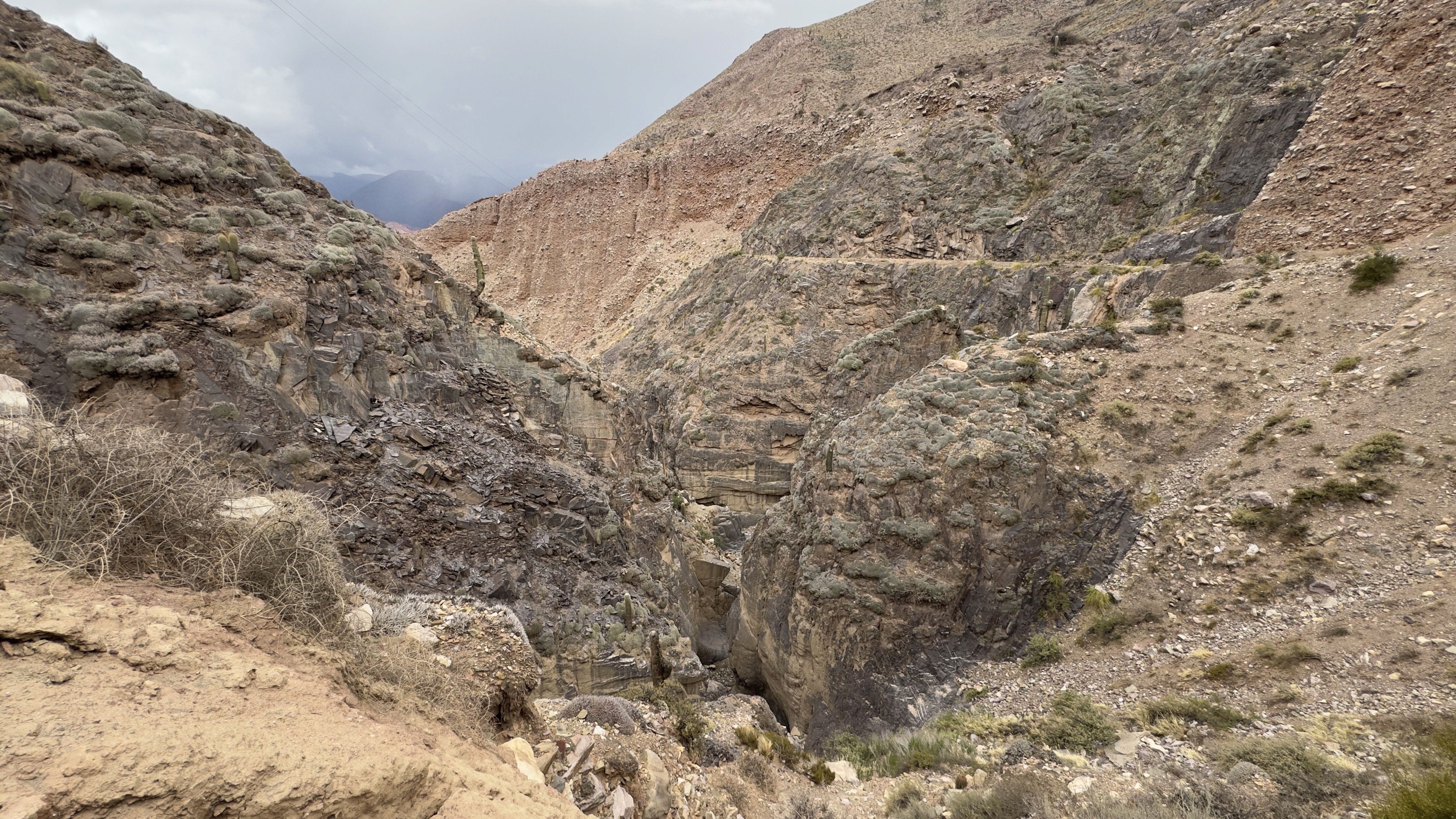
Quebrada de las Conchas
Free access
A series of red and ochre rock formations sculpted by wind and water that are stunning to admire along the way.
Recommended stops:
Devil's Throat
The Amphitheater
The Castles
Each stop is directly accessible from the road, without complicated walking.
What to do once in Cafayate?
Cafayate is known for its vineyards and its emblematic grape variety, the torrontés.
Must-see:
Local wineries
Free entry or tasting between 10,000 and 16,000 pesos depending on the wineriesMain square for a quiet evening
Where to sleep:
Hostels or small hotels in the city center, unfortunately, we could not stay overnight in this city, so we could still recommend a place.
Cafayate is ideal for a quiet first night before tackling Route 40.
Day 2. From Cafayate to Cachi via Route 40
A longer day, but one of the most beautiful of the trip on the Salta loop.
The places to see on Route 40 towards Cachi
Quebrada de las Flechas
Free access
An almost lunar landscape, with rocks pointing towards the sky.Recta del Tin Tin
A perfect straight line in the middle of the Los Cardones National Park.Parque Nacional Los Cardones
Free access
Thousands of giant cacti in a silent and impressive valley.
The town of Cachi
It is a small Andean village, peaceful, perfect for slowing down. It is simple but pleasant to stop there.
To see:
Iglesia San José
Museo Arqueológico de Cachi
Entrance approximately 1,500 pesos
Where to sleep:
Small inn or local hospedaje
Cachi is an excellent point to cut the loop and rest.
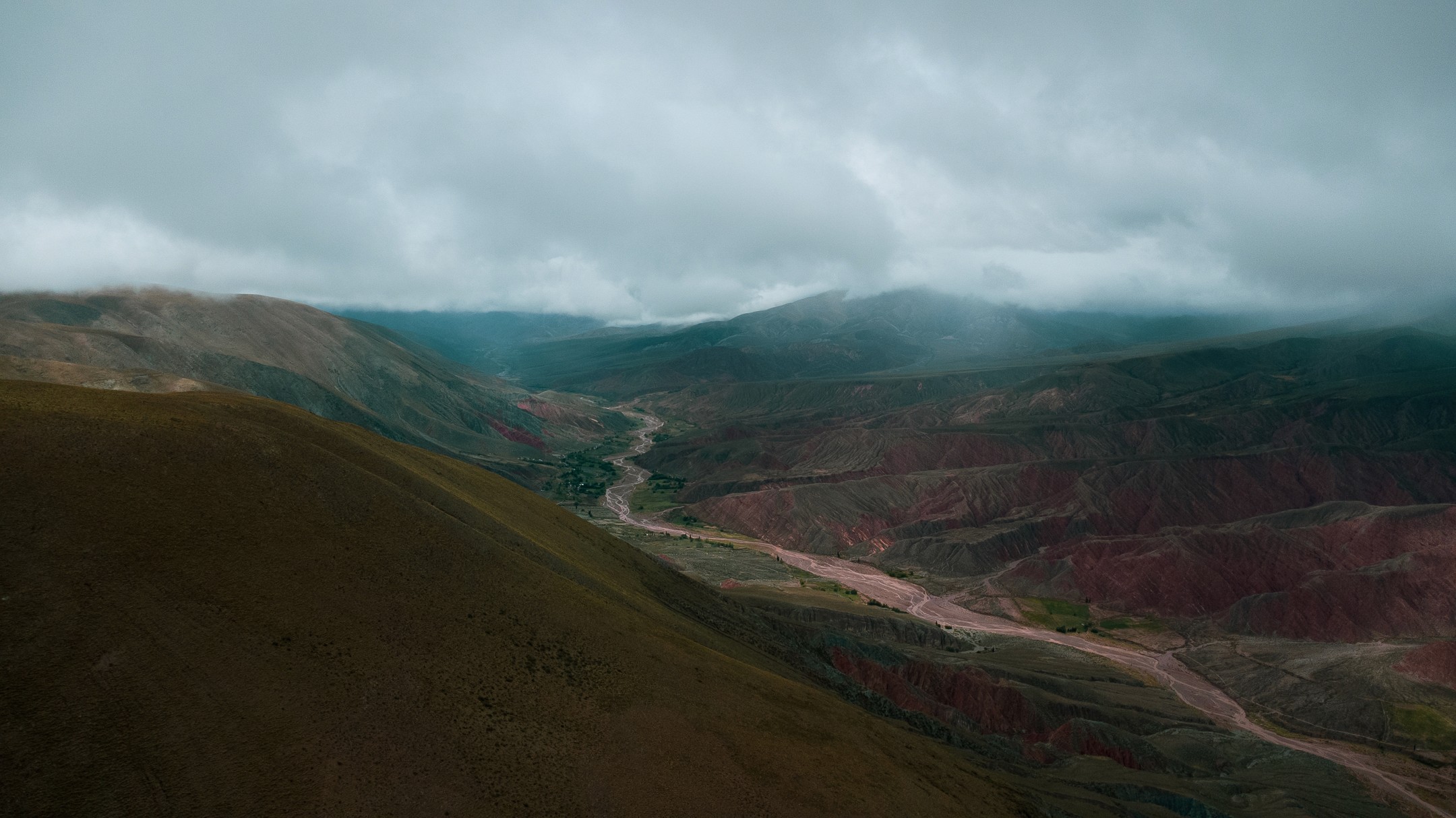
Day 3. From Cachi to Salinas Grandes
This is the longest road and it gradually climbs in altitude, the landscapes become more arid. You should not take road 79 unless you have a pickup, otherwise you risk getting stuck in a section of the road.
Places to see on the road to Salinas Grandes
Cuesta del Obispo
Free access
A spectacular winding road with stunning viewpoints.Piedra del Molino
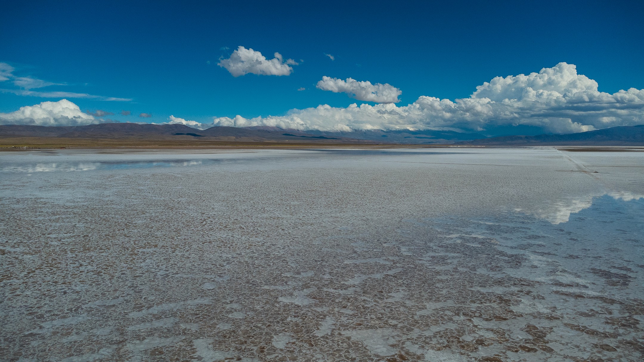
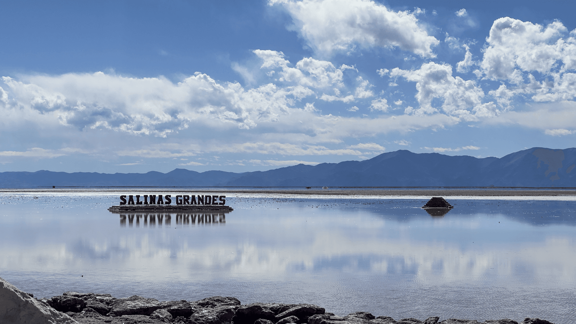
About 3,300 meters in altitude, ideal for a break.Salinas Grandes
The entry to walk on the desert is 10,000 pesos per person, it does not accept cards and there is no ATM nearby.
It is a vast active salt desert, at over 3,400 meters. A short guided tour is included.
Tip: protect yourself from the sun, the glare is very strong.
Where to sleep after Salinas Grandes:
Lodges or small inns on the road to Purmamarca or Tilcara
Sleeping a little lower helps to better manage the altitude.
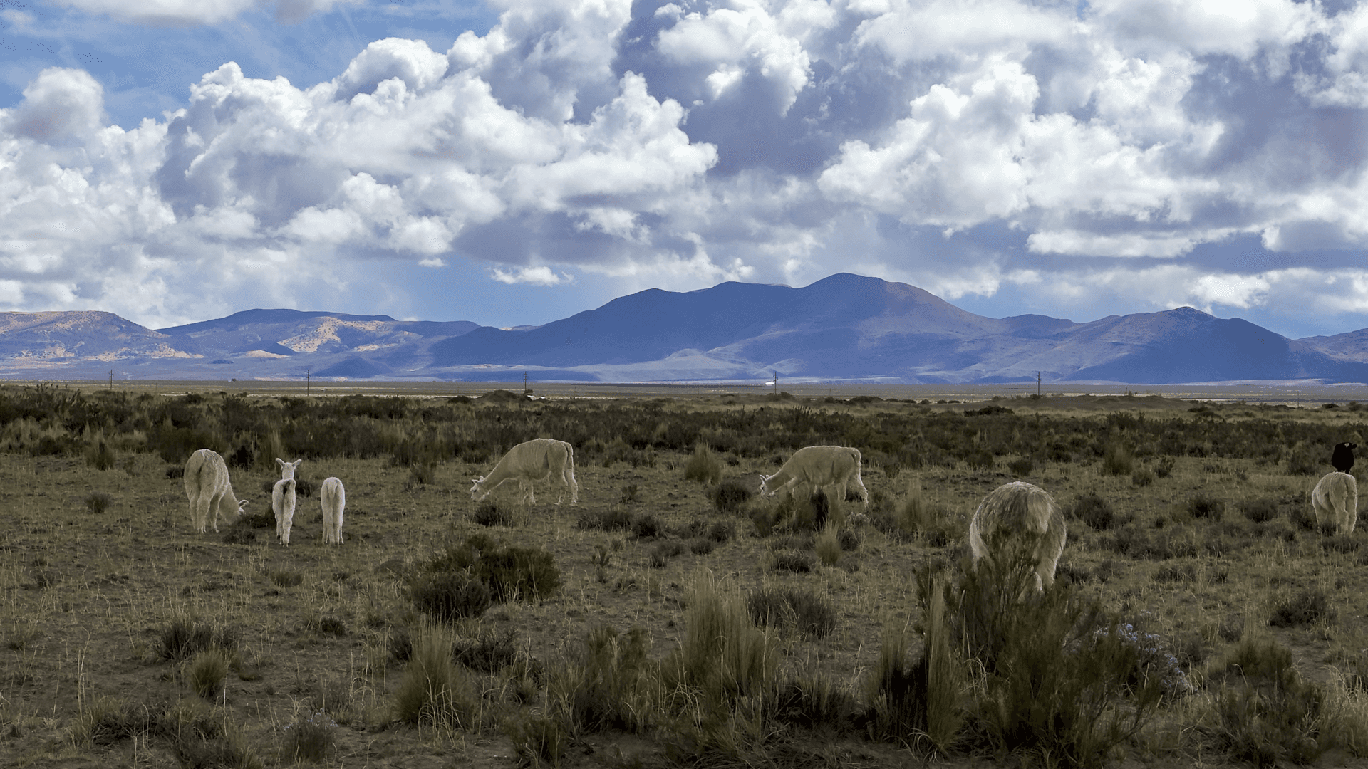
The Salta Loop - Jujuy in Photos

Day 4. From Salinas to Tilcara and the Quebrada de Humahuaca
We gradually descend, the air becomes more breathable.
Places to see near Tilcara
Purmamarca and the Hill of Seven Colors
Free access
Best visited early in the morning or at the end of the day.Pucará de Tilcara
Entry about 2,000 pesos
Ancient pre-Hispanic fortress with a view of the valley.
Tilcara
Vibrant town, deeply rooted in Andean culture. Depending on the time of year, you can see festivities in the evening! Ask the locals directly, they love to chat! We really enjoyed spending the evening in this town.
Where to stay:
Tilcara Mistica Hostel: We found this hostel that has just changed owners, and the new ones are really very approachable, having traveled themselves, they know what adventurers need! A great place for a lively yet relaxed evening.
Day 5. From Humahuaca back to Salta
You will need to climb for 1 hour and a half to reach Humahuaca. Once there, you will need to take the road towards the viewpoint, which is magnificent for the final ascent. Then, depending on your condition, you may gradually return to Salta in 3 to 4 hours depending on traffic.
Places to see
Humahuaca
Town listed as a World Heritage Site
Altitude approximately 4,350 metersMirador de la Serranía del Hornocal
Entry approximately 1,500 pesos
A spectacular multicolored mountain, accessible by track. To be done only if the weather is good.
Beware of altitude sickness, Tristan had migraines for 2 days at high altitude, so hydrate and take it easy.
Return to Salta in the afternoon or end of the day.
A loop to live in the rhythm of the mountain
The Salta Jujuy loop is not a road trip that one consumes quickly. It is a journey where altitude, light, and landscapes dictate the pace. Over five days, one takes the time to observe, to stop, to breathe, and above all, not to endure the journey.
Taking a step back, this loop between Salta and Jujuy tells much more than just a simple sequence of landscapes. Long before the arrival of the Spaniards, these valleys and plateaus were already transit lands for Andean peoples such as the Diaguitas, the Omaguacas, or the Atacamas, who lived in close relation with altitude, climate, and seasons.


Later, the Inca Empire integrated this region into its vast network of trade routes, some of which still exist today.
With colonization, northern Argentina became a strategic axis connecting Upper Peru to the rest of the territory, used for transporting minerals, cattle, and goods. This history of constant circulation can still be felt everywhere, in the villages, markets, architecture, and local traditions.
Traveling here means following a path shaped over centuries by adaptation, exchange, and life at high altitudes, which makes this loop even more striking once the engine is turned off and silence returns.