3 days in Atacama and Uyuni by 4x4: budget and practical tips
Discover our complete guide to the 3-day 4x4 road trip between San Pedro de Atacama and the Salar d'Uyuni. Day by day, we share our journey through colorful lagoons, geysers, the giant salt flat mirror, surreal rock formations, and all our practical tips to help you experience this unforgettable adventure across the Bolivian Altiplano. From budget and altitude to packing essentials: here is everything you need to know before you hit the road.
3 days in Atacama and Uyuni by 4x4: budget and practical tips
There are some journeys that completely change the way you see the world. The 3-day 4x4 trip between San Pedro de Atacama in Chili and the Salar d'Uyuni in Bolivia is definitely one of them. This isn't just your average tourist excursion: it is a true crossing of the South American Altiplano, reaching heights of over 4,000 meters above sea level, traveling through landscapes so immense they feel like they belong on another planet.
Over three days, you will journey past lagoons of unbelievable colors, geysers spitting steam at dawn, rock deserts sculpted by the wind, abandoned villages frozen in time, and finally, the largest salt flat in the world, transformed into a giant mirror during the rainy season. It is a concentration of sensory experiences that very few trips on Earth can ever match.
We took this trip in April 2026, right at the end of the wet season, which gave us the perfect conditions to witness the famous mirror effect on the salt flats. Traveling in a Toyota Land Cruiser, our group of six travelers, led by our guide Mario, crossed the Bolivian Altiplano, staying in basic but welcoming refuges, sharing meals around communal tables, and discovering breathtaking panoramas together.
This guide is based on our firsthand experience. Every place described and every piece of advice shared comes from what we actually lived, photographed, and noted down during those three days.
Our goal: to give you all the tools you need to experience this adventure in the best possible way.
Planning your departure from San Pedro de Atacama
The 3-day Atacama-Uyuni trip is usually booked from San Pedro de Atacama. Many agencies offer this tour, but the quality and price can vary heavily from one provider to another. The guide makes all the difference: they are the ones driving the 4x4 on unmarked dirt tracks, choosing the best photo spots, handling mechanical issues at 4,500 m of altitude, and ensuring your safety on sometimes treacherous roads.
We traveled with Mario, a Bolivian guide based in Uyuni who has been working this route for over ten years. He knows every bend, every lagoon, and the perfect viewpoint depending on the time of day. His professionalism and local knowledge completely transformed our experience. You can reach him directly via WhatsApp at +591 67923749 to organize your trip.
The price is around 200 USD per person for the three days, which includes transport in a shared 4x4 (maximum of 6 people), basic lodge accommodation, meals (breakfast, lunch, dinner), and national park entry fees.
Which way to go: Atacama to Uyuni or the other way around?
You can do this trip in either direction, but starting from Atacama and heading to Uyuni has a major strategic advantage: you'll acclimatize to the altitude gradually over the first two days (climbing from 2 400 m in San Pedro up to 4 800 m at the geysers). Plus, it saves the Salar de Uyuni for the grand finale—the true emotional highlight of the journey. Arriving at the salt flats just as the sun rises on your final day, after building up the anticipation for two days, is the perfect crescendo.
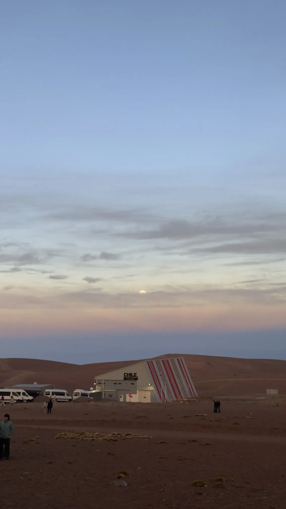
What's more, if you finish your journey in Uyuni, you can easily catch a bus to continue on to La Paz, Sucre, or Potosi. The Chili-Bolivia border crossing takes place on your first morning, right at the Hito Cajón border post, and the formalities are pretty straightforward. Just keep your passport handy and pack a little patience.
When to go: choosing the right season
The dry season (May to October) guarantees blue skies and easier roads, but the salt flat is completely dry: no mirror effect. The rainy season (December to March) brings water to the salt flat, creating that famous mirror, but some areas might be inaccessible and the refuges less comfortable. The absolute best time to go is during the transition: late March, April, and early May. You still get water on the flats for the mirror effect, but the rains have stopped and the roads are clear. That's exactly the window we had in April.
Day 1: Lagoons, geysers, and pink flamingos
Dawn departure and border crossing
The alarm goes off at 4:00 AM in San Pedro de Atacama. The 4x4 picks you up from your hostel in the pitch black. The first hour of the drive is in total darkness, climbing steadily towards the Bolivian border. As dawn breaks, the first volcanoes appear as silhouettes on the horizon: Licancabur and Juriques, two snow-capped giants marking the border between Chili and Bolivia.
As soon as your passport is stamped, the scenery changes dramatically. The mineral aridity of the Atacama Desert gives way to a more colorful, wilder, and more rugged altiplano.
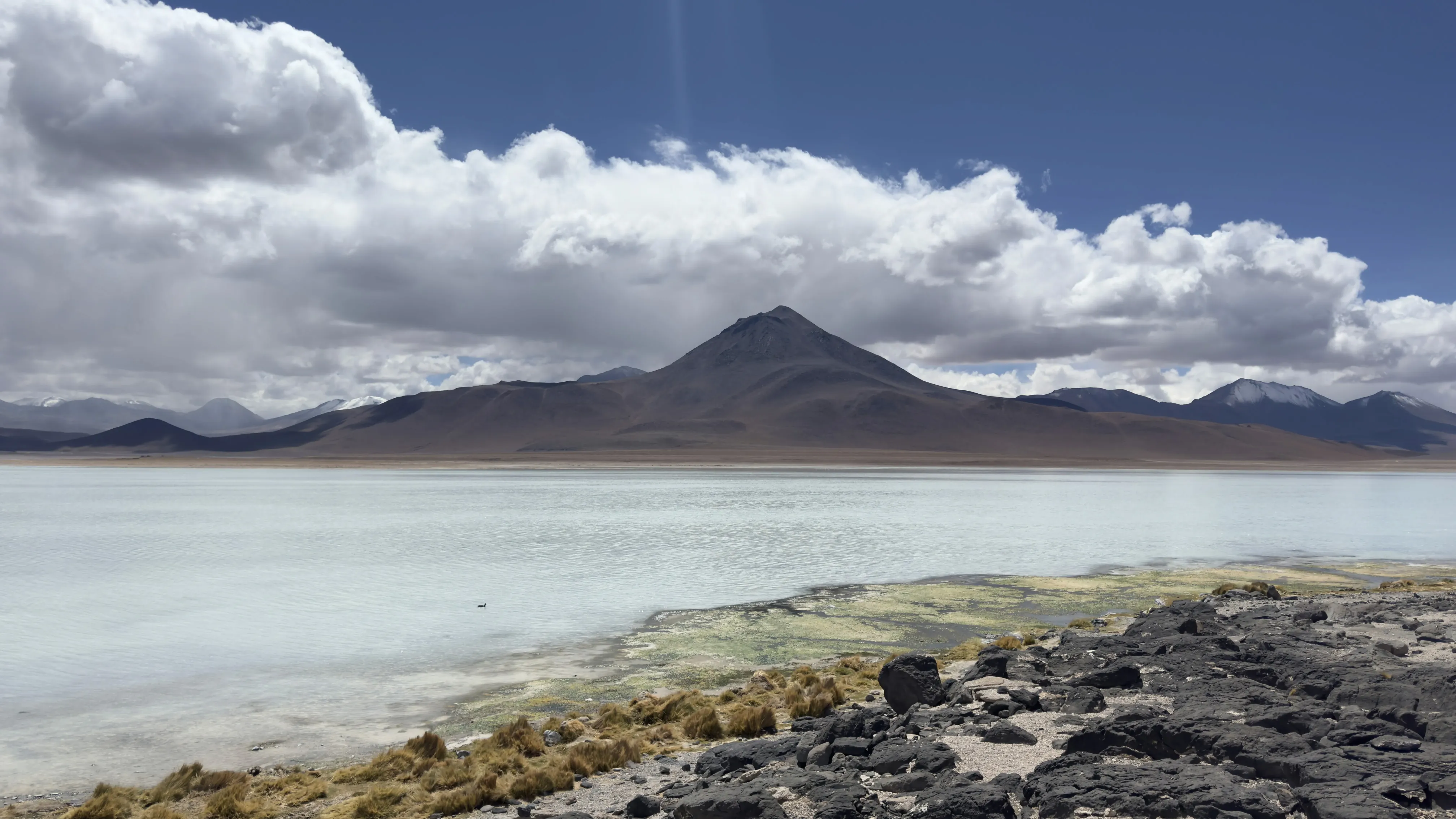
Laguna Blanca and Laguna Verde
First stop, and already it takes your breath away. Laguna Verde appears at the foot of the Licancabur volcano, its deep turquoise water contrasting sharply with the brown of the surrounding mountains. The color comes from dissolved minerals (arsenic, magnesium, lead carbonate) that react with the sunlight. The wind sweeping across the surface creates shifting reflections, changing from emerald green to deep blue depending on the angle.
Right next to it, Laguna Blanca offers a striking contrast with its milky white waters. Both lagoons sit at about 4,350 meters above sea level, and the cold is biting at this early hour. Make sure to pack warm layers and a beanie: even in April, temperatures drop below freezing in the early morning.
Sol de Mañana: the altiplano geysers
The 4x4 heads back onto the trail toward the north and stops at the Sol de Mañana geysers, at 4,850 meters above sea level. This is the highest point of the trip, and the geothermal activity is spectacular: plumes of sulfurous steam shoot out from the ground, gray mud pools bubble with eerie gurgles, and the smell of sulfur hangs heavy in the freezing air. It feels like being on an inhospitable planet, with the silhouettes of the other parked 4x4s in the distance as your only landmarks.
Warning: stick to the marked paths. The earth's crust is thin in places, and falling into a geothermal pool would be disastrous.
Laguna Colorada: the kingdom of the flamingos
The afternoon of the first day is dedicated to Laguna Colorada, undoubtedly the most photogenic moment of the day. This massive lagoon (60 km²) boasts a blood-red color caused by algae and mineral sediments. Hundreds of Andean flamingos (James's flamingos) feed in its shallow waters, creating a living picture of absolute beauty.
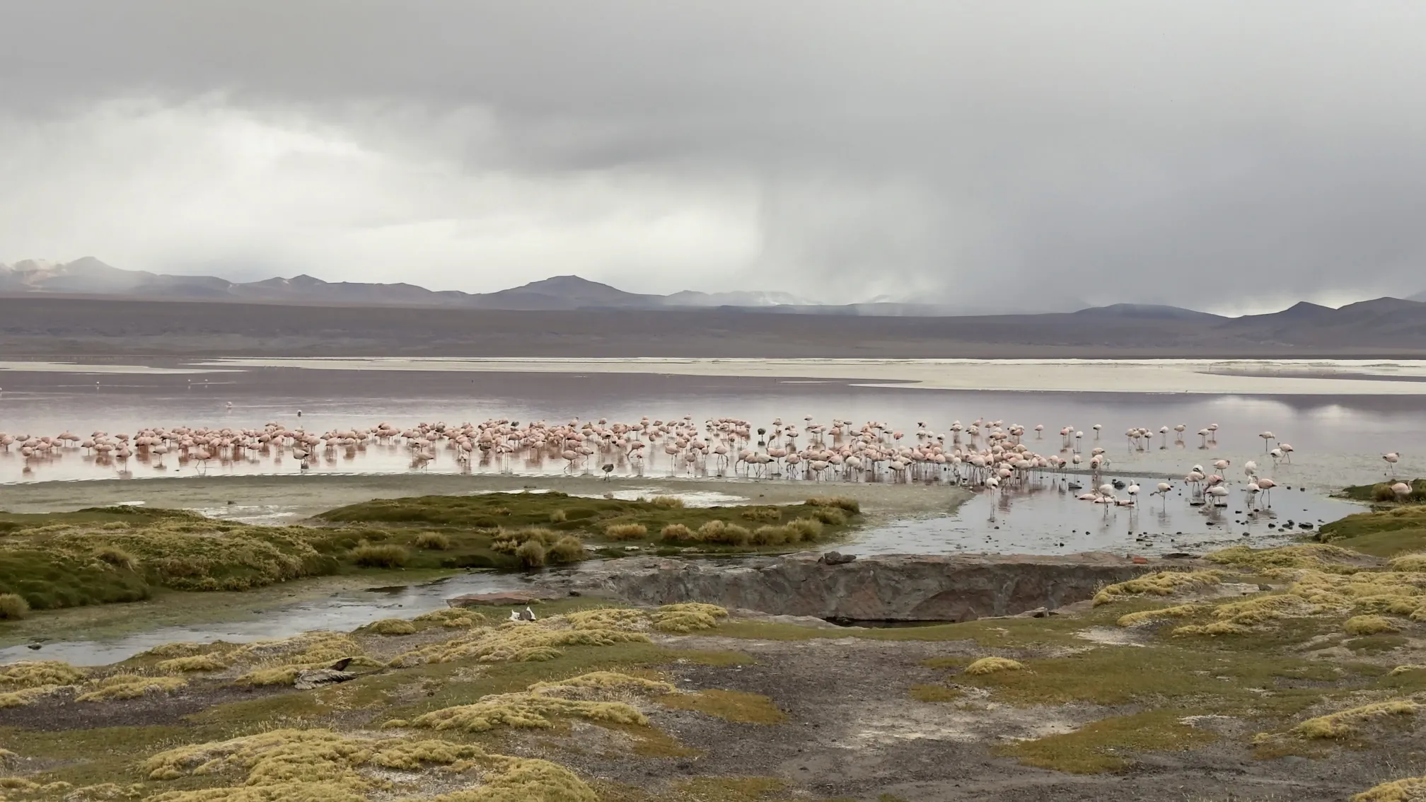
The contrast between the red water, the white borax crystallized on the shores, the pink of the flamingos, and the intense blue of the sky at 4,278 meters is almost surreal. It is one of those moments when you realize that nature always outdoes human imagination. Take your time here: groups usually stay for 45 minutes to an hour, and every minute is worth soaking in.
The road leading to the evening's shelter crosses a desert altiplano, flat to the horizon, where only a few wild vicuñas break the apparent monotony of the landscape. The sunset over this empty vastness is a spectacle in its own right. The shelter is cozy for the area: a comfortable bed, thick blankets, a hot shower, and a hearty meal.
Day 2: rock formations, canyons and ghost towns
Waking up in the altiplano
The second day starts under a beautiful sun. Breakfast at the refuge is simple yet comforting: bread, jam, coca tea (an absolute must for the altitude) and hot coffee. The first rays of sunlight gradually warm up the stone, and the landscape is painted in gorgeous shades of gold and orange.
The second day is all about geological wonders. We leave the world of lagoons behind to enter a realm of rock sculpted by millions of years of wind erosion. The wind is the master sculptor of this region, and its creations are as unreal as they are unlikely.
Italia Perdida: nature's own architecture
Our first major stop today is Italia Perdida (also known as Valle de las Rocas), a stunning collection of colossal rock formations that look just like ruined buildings. Natural arches, towering stone pillars, and dizzying overhangs shape a landscape that feels like an ancient, abandoned city. We spent quite a while exploring these formations, wandering under the arches, and scrambling up the rocks to take some great group photos.
The morning light is absolute perfection for photographing these formations, with the deep shadows highlighting the rugged reliefs and textures of the volcanic rock. Some of these formations reach about 15 to 20 meters high, and the silence that fills the air out here is incredible. All you can hear is the wind whistling through the stones—it's one of those spots where time simply stands still.
Mirador de la Anaconda: a dizzying canyon
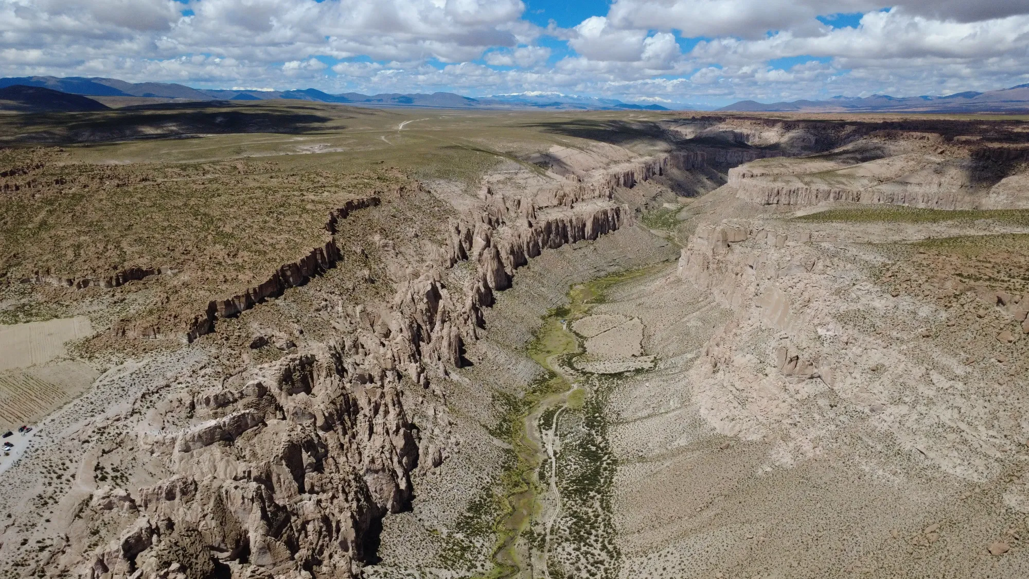
Later in the morning, our 4x4 pulls up to the edge of what looks like a canyon that appeared out of nowhere. The Mirador de la Anaconda offers a breathtaking, birds-eye view overlooking a deep canyon with walls striped in vibrant shades of red, ochre, beige, and gray. The winding river at the bottom snakes along, giving the place its iconic name. Captured from our drone (we had a handy DJI with us), the view is absolutely magnificent.
This viewpoint doesn't get many visitors from the groups traveling in the opposite direction (from Uyuni to Atacama), as it lies along a different fork in the trail that not all guides are familiar with. That's the beauty of having an experienced guide like Mario—he knows these scenic detours that take a great trip and make it truly unforgettable.
Julaca: the ghost town station at the edge of the world
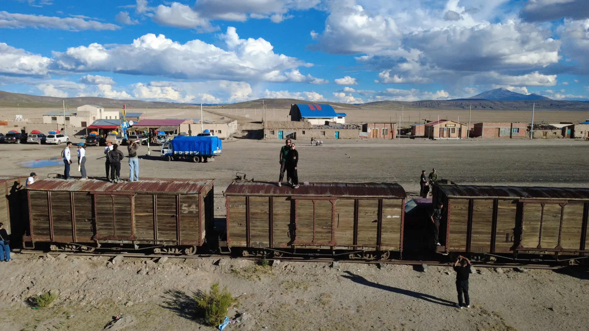
One of the absolute highlights of our second day has to be stopping in Julaca, an abandoned railway station sitting in the middle of nowhere. Old, rusty train cars sit quietly on tracks partially covered by sand, and the small stone station feels frozen in time, as if the passengers just stepped away a century ago. We climbed onto the old carriages to grab some photos—the post-apocalyptic vibe of the place is incredibly cool.
This railway line once linked the local mines to the ports on the Pacific coast. When the mining industry declined, the trains stopped running, and the stations were simply left behind, forgotten. Julaca isn't alone either; several ghost stations are scattered across the Bolivian Altiplano, but this one is especially photogenic because of the vintage carriages still sitting on the tracks.
Altiplano villages and local life
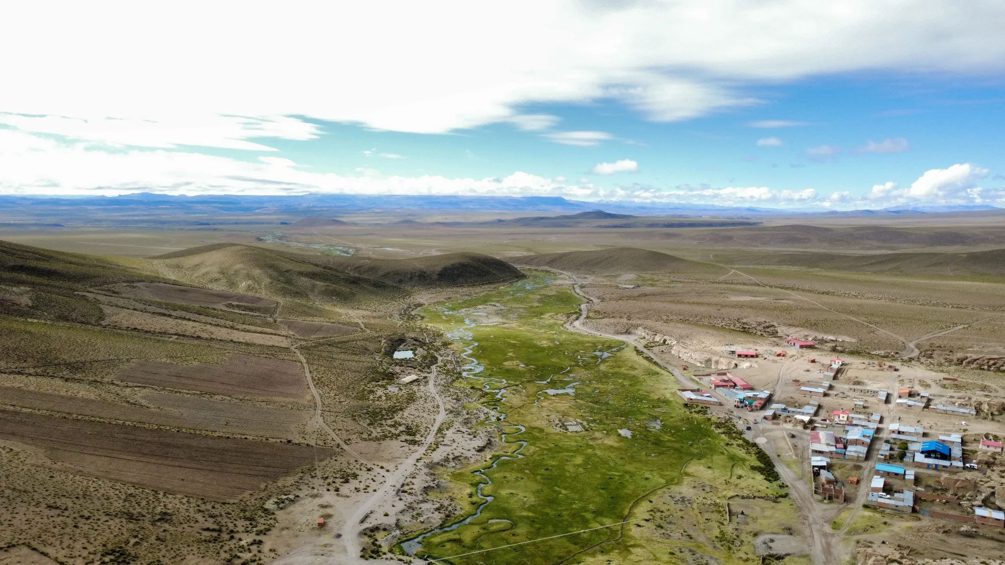
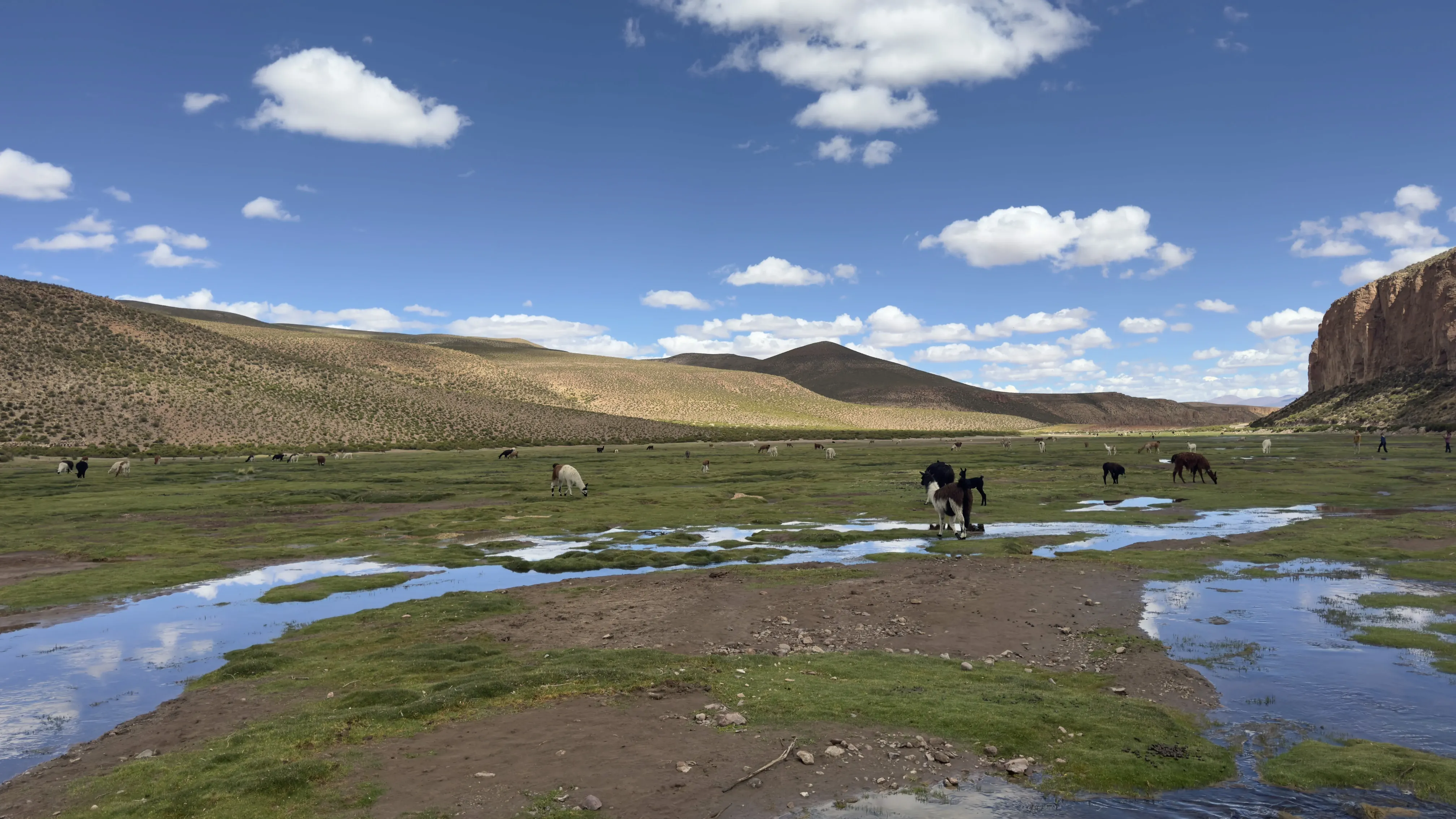
Between our main stops, the trail takes us through tiny, high-altitude villages where life moves at its own slow pace. You'll see traditional adobe houses with tin roofs, tiny churches, and dirt-floor soccer fields where alpacas peacefully graze when there isn't a game on. We flew the drone over one of these villages, and the aerial view is stunning: a vibrant green river winding between the homes, stone walls dividing the land, and a beautiful sense of peace and solitude.
Lunch on the second day is usually enjoyed in one of these villages, either in a local home or at a small, cozy comedor. The menu is simple and hearty: quinoa soup, rice, chicken or llama meat, and plenty of warm coca tea. The hot meal is a lifesaver after spending the morning out in the chilly Altiplano wind.
Cactus valley and the 4x4 caravan
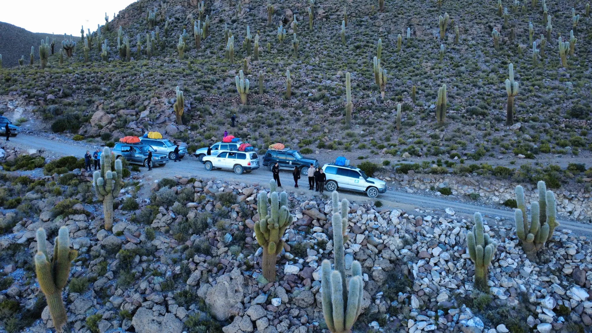
To round out the second day, we head through a beautiful valley filled with giant cacti, likely near the Isla Incahuasi area. These towering cardon cacti can reach anywhere from 5 to 8 meters tall and have been growing for hundreds of years. Capturing an aerial shot of our 4x4 convoy navigating through these ancient green sentinels is one of the coolest images from the whole trip.
Our second night's lodging is located close to the salt flats, usually in the village of Colchani or nearby. You can feel the excitement building in the air: tomorrow is the big day at the Salar d'Uyuni, the moment we've all been waiting for. Dinner is a lively affair with all six travelers in our group swapping photos from the day and chatting about tomorrow's early start. We'll need to turn in early tonight—wakeup is set for 4:00 AM so we can be out on the salt flats before the sun comes up.
Day 3: Salar d'Uyuni, the mirror desert
Driving to the salt flats in the dark
Our third day begins in total darkness. By 4:30 AM, the 4x4 is already cruising along a track that gradually turns into a salty crust. Inside the vehicle, the headlights illuminate a white expanse stretching endlessly in every direction. The horizon disappears, and there are absolutely no landmarks to guide you. The 4x4's rearview mirror reflects nothing but pitch black behind us. It truly feels like navigating through an empty void, suspended between heaven and earth.
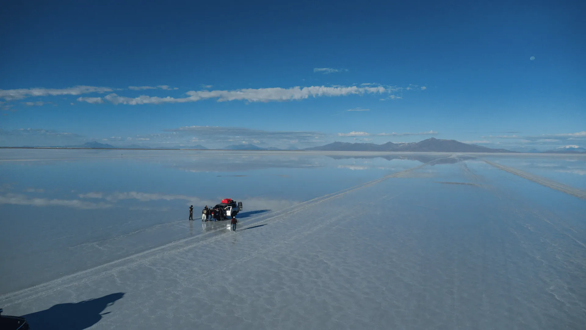
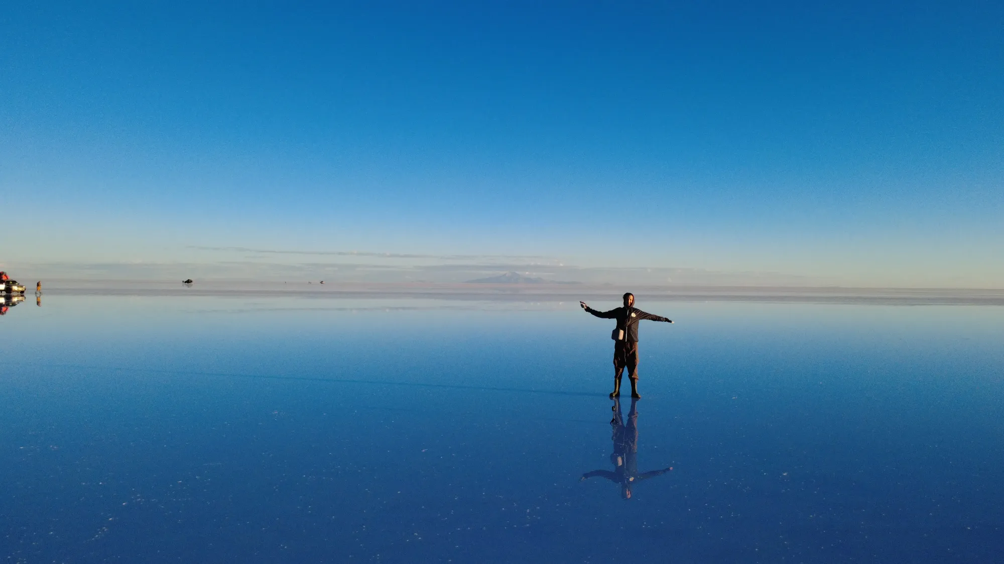
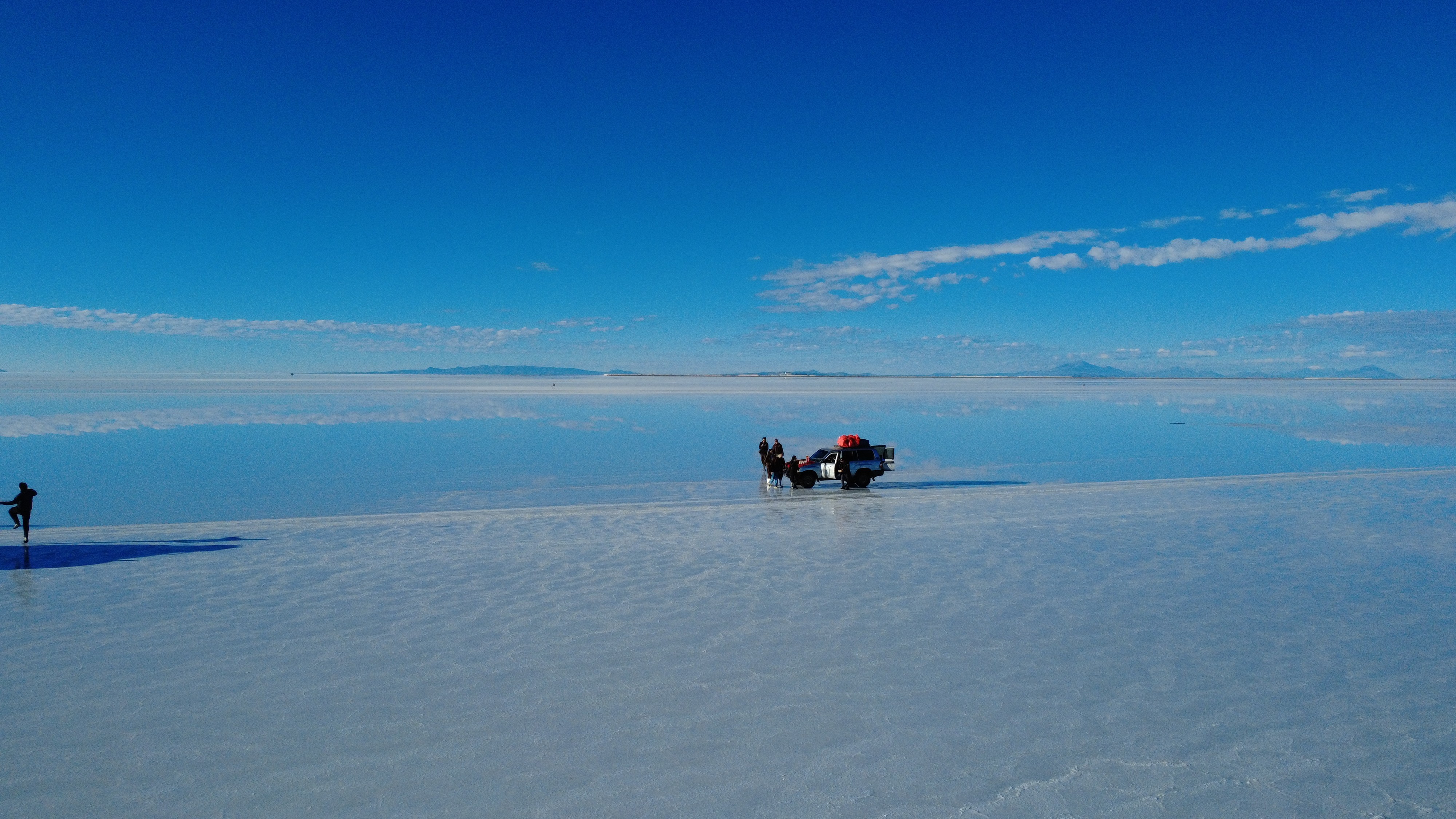
Then, little by little, a thin sheet of water appears beneath the wheels. It's barely a few inches deep, but it's enough to transform the salt desert into the world's largest natural mirror: 10,582 km² of perfectly reflecting surface. The sky, the clouds, and the stars slowly fading away—everything is reflected with mind-blowing clarity in this motionless water.
Sunrise over the mirror
The 4x4 comes to a stop. Mario cuts the engine. The silence is complete, absolute, almost overwhelming. We step out of the vehicle and onto the mirror. The water barely reaches the soles of our shoes, but the reflection is so flawless that you feel as if you are walking on air. The horizon has vanished: the sky and the ground have merged into one.
Then the sun rises. The first orange glow appears in the east, and instantly, the entire salt flat is bathed in warm hues. The reflection mirrors every cloud, every streak of light. You stand in the middle of infinity, with no spatial reference, floating between two identical skies. It is one of the most surreal moments a traveler can ever experience.
The group photo: an iconic keepsake
The absolute highlight of day three, and probably of the entire trip: the group photo. Six people holding hands, standing on a perfect mirror with their symmetrical reflection right below them. Seen from the drone, the shot is breathtaking: tiny human silhouettes lost in an infinite space, with no visible horizon, suspended between heaven and earth. We all set this photo as our phone background. It perfectly sums up the sheer immensity and beauty of this experience.
Mario also took some classic perspective photos with us (playing with depth of field and the size of objects thanks to the lack of visual reference points), as well as synchronized jumps and individual portraits against the setting sun. Every single minute on the salt flats is a photo opportunity. The drone (a DJI) was an invaluable asset for capturing the vastness of the landscape from above.
Crossing the salt flats and arriving in Uyuni
After the morning photo session, the 4x4 heads across the salt flat toward Uyuni. Driving on the salt is an experience in its own right: a flat surface stretching as far as the eye can see, hexagons of dried salt forming a mesmerizing geometric pattern, and occasional flooded areas that kick up sprays of water under the wheels. The drive takes about two hours to reach the town of Uyuni.
The arrival in Uyuni marks the end of the journey. The town itself is modest and doesn't have much tourist appeal, but it offers direct buses to La Paz (about 10 hours), Sucre (7 hours), or Potosi (3 hours). Most travelers set off for one of these destinations that very evening or the following morning. It’s also time for farewells to Mario and your road trip companions: spending three days together in a 4x4 creates quick bonds.
The 3-day trip stays under the 50 euros per day mark per person, making it an exceptional experience in terms of value for money. For comparison, a similar trip in Iceland or Namibia would easily cost three to four times more.
Altitude: challenge number one
Altitude sickness (soroche) is the main hazard on this trip. You will spend three days between 3,600 and 4,850 meters above sea level, with a rapid ascent on the first day. The most common symptoms are headaches, nausea, breathlessness at the slightest effort, and sleep trouble. To minimize the risks: spend at least 2 to 3 days in San Pedro de Atacama before starting (at 2,400m, you're already at altitude), drink plenty of water (3 liters a day minimum), avoid alcohol in the preceding days, and chew on coca leaves or drink coca tea from day one.
If symptoms become severe (confusion, vomiting, difficulty breathing at rest), you must go down immediately. Mario has an oxygen tank in the 4x4 for emergencies. Don't underestimate the altitude: it's serious business, even for fit and healthy travelers.
Essential gear
The list of essential gear for this trip isn't long, but every item is crucial. Sun protection with at least SPF 50: at this altitude, the UV index is extreme and sunburn can happen in 15 minutes. Category 4 sunglasses: a absolute must on the salt flat where the glare is blinding. Layered warm clothing: mornings and evenings are freezing (-15 to 0 degrees), but afternoons can reach 15-20 degrees in the sun. Cash in Bolivianos: there are no ATMs along the route, and the basic guesthouses only accept cash for extras (beer, hot showers, snacks). Power bank: electrical outlets are scarce in the refuges, and the cold drains batteries twice as fast.
Other handy items: a beanie and gloves for the mornings, waterproof shoes for walking on the flooded salt flat (the salt water ruins leather shoes), a personal sleeping bag if you tend to get cold (the refuges provide blankets, but they might not always be enough), and of course a camera with plenty of storage. A drone, if you have one, is an absolute must-have for the salt flat.